Itineraries
Civic District to Marina Bay Waterfront Walk: A Pedestrian Arts, Heritage and Garden Loop in Singapore, Singapore
Explore Singapore’s Civic District, cross the Marina Bay waterfront, and wander Gardens by the Bay — all on a contiguous, officially pedestrianised walking loop. This practical guide shows how recent civic upgrades connect the city’s heritage, public art, and green spaces for a seamless pedestrian experience.
AI illustration · Wardhead AI · AI-generated illustration
Introduction
Singapore’s Civic District and Marina Bay area offer one of Southeast Asia’s most walkable city centre loops, newly enhanced by the pedestrianisation of key roads and bridges. This guide details how visitors can stroll from the city’s museums and colonial landmarks, across the iconic waterfront, and onwards through award-winning gardens — all on foot and with clear signage, thanks to a coordinated effort by Singapore’s city planners and tourism authorities.
Why Walk This Civic–Bay Loop?
Recent road repurposing in Singapore’s Civic District has prioritised pedestrians along historic Connaught Drive, Anderson Bridge, and Fullerton Road. This shift allows visitors to enjoy major attractions in a contiguous route: start by exploring heritage buildings and premier art museums, continue to Marina Bay’s waterfront promenade, and finish with a walk across to Gardens by the Bay’s futuristic landscapes. Linked footbridges, signage, and wayfinding maps make this route practical, pleasant, and rewarding for first-time or return visitors alike.
Start: Civic District — History, Museums, and Arts
Official city improvements have transformed the Civic District’s public realm. The pedestrianised stretch from Empress Place and the Padang to the Singapore River now provides uninterrupted access for walkers. Key features include:
- Empress Place: A historic riverside open space linking to the Asian Civilisations Museum, which explores pan-Asian cultures within a British colonial-era building.
- The Padang: A monumental lawn surrounded by governmental and cultural buildings.
- National Gallery Singapore: The city’s flagship art museum, uniting the former Supreme Court and City Hall. The Gallery is part of the Civic District Alliance that advocated for the area’s pedestrianisation.
This segment also includes shaded walkways, benches, and landscape upgrades. Plan to linger at arts venues or simply enjoy the tree-lined setting made more accessible by urban design policies (lta.gov.sg ↗).
Crossing the Singapore River — Anderson Bridge and Cavenagh Bridge
From the Padang and Fullerton Square, use Anderson Bridge — now officially reserved for pedestrians — to cross the river. This arched bridge, over a century old, offers views of Singapore’s colonial and financial districts. Nearby, the ornate Cavenagh Bridge (pedestrian only) provides a short architectural detour and photo opportunity.
Marina Bay Waterfront Promenade — City Views and Landmarks
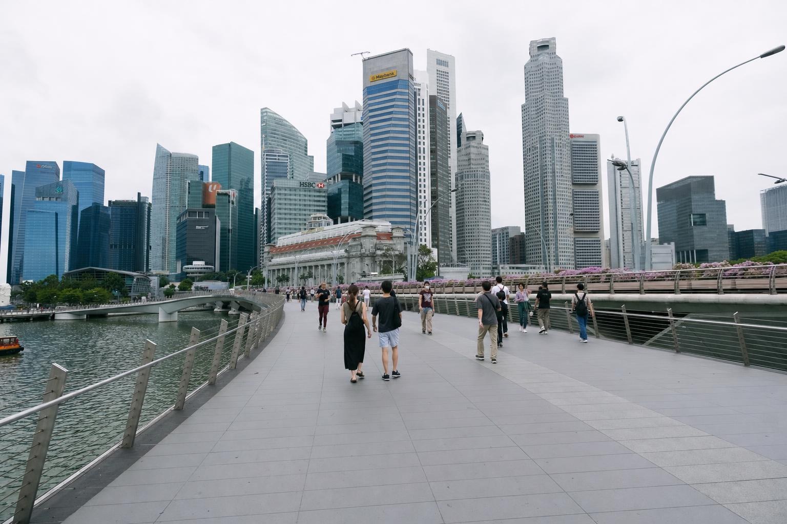
After crossing the river, the legendary Fullerton Hotel anchors the entry to Marina Bay. This modern district is known for its skyline, waterfront promenades, and lively atmosphere.
- Bayfront and Event Plaza: Wide, smooth promenades skirt the bay, providing vantage points to the city’s architectural icons, including Marina Bay Sands and the Singapore Flyer.
- Public Art and Green Spaces: Interspersed with sculptures, water features, and seating, the promenade is popular for strolls at all times of day and offers shaded rest stops.
The area is designed for walkability, as confirmed in city maps and route guides, and connects directly to the main entrance of Gardens by the Bay via the Dragonfly Bridge (visitsingapore.com ↗).
Linking to Gardens by the Bay — Dragonfly Bridge
The Dragonfly Bridge, specifically designed for both pedestrians and cyclists, takes you across the water into Bay South Garden. Visitor maps highlight Dragonfly and Heron bridges as primary connectors between the waterfront and the gardens (visitsingapore.com ↗).
Gardens by the Bay — Futuristic Gardens and Conservatories
Few urban parks rival the scale or ambition of Gardens by the Bay. Its main attractions are:
- Supertree Grove: Vertical gardens that light up each evening, forming a striking city silhouette.
- Flower Dome and Cloud Forest (conservatories): Glasshouses with rare plants and immersive displays.
- Bay East Garden: Quieter, more open spaces for waterside walks.
- Art Trails: Sculptures and permanent installations guide visitors through the garden’s themed paths (visitsingapore.com ↗).
The pedestrianised route, as mapped in official guides, leads to clear entrances for these sights, with orientation maps and garden staff on hand for directions.
Return, Loops, and Public Transport
The loop can be extended or shortened. To return to your starting point or connect to other parts of Singapore:
- Continue on foot around the entire Marina Bay waterfront, making a near-complete circle via the Helix Bridge (which returns towards the Esplanade theaters and Civic District), or
- Connect to MRT stations along the Circle Line and Downtown Line: Bayfront, Downtown, Esplanade, and Raffles Place are all within walking distance of this route (lta.gov.sg ↗).
Accessible routes, clear signage, and improved crossings are specifically enabled by LTA’s ongoing road repurposing programme (lta.gov.sg ↗).
Planning Your Walk: Advice and Checklist
- Consult updated precinct maps on the official visitor website or with the National Gallery Singapore for real-time route information and temporary event overlays.
- Carry water and sun protection: Most of the route is unshaded, though trees and indoor venues offer respite.
- The route is suitable for wheelchairs and strollers, with curb cuts and step-free grades most of the way.
- Check Gardens by the Bay’s site for special exhibitions, garden closures, or event dates that might affect entry to specific domes.
- Use Circle Line or Downtown Line MRT for efficient access to both route ends and return journeys.
Evidence Gaps & Limits
While official sources confirm the layout and pedestrianisation of these public spaces, there is INSUFFICIENT EVIDENCE for temporary accessibility changes, construction detours, or unique event day arrangements — always consult local signage and official online updates close to your visit.
Conclusion
This Civic District to Marina Bay Waterfront Walk demonstrates Singapore’s evolving approach to public space and urban walkability, making it possible to experience colonial heritage, world-class art, signature city views, and lush modern gardens in a single, stress-free walking loop.
Key takeaways
- Singapore’s Civic District, Marina Bay and Gardens by the Bay are linked by officially pedestrianised routes, enabling a seamless city walking experience.
- The Civic District’s key attractions — Asian Civilisations Museum, National Gallery — are now more accessible due to the removal of through-traffic on Connaught Drive and Anderson Bridge.
- Dragonfly Bridge allows direct walking access between Marina Bay’s waterfront promenade and the main attractions of Gardens by the Bay.
- Official wayfinding and route maps support safe, continuous foot travel with access to public transport on the Circle and Downtown MRT lines.
- The loop passes signature arts, heritage and modern garden sites, making it suitable for first-time or returning visitors.
- Accessibility is prioritised in design, but always check for temporary changes due to events or works before visiting.
Comparisons & planning
| Stop/Segment | Official Pedestrianisation | Main Attractions | Linkage/Bridge | Public Transport Nearby | Source |
|---|---|---|---|---|---|
| Empress Place / Padang | Yes (Connaught Drive) | Asian Civilisations Museum, Padang, Victoria Theatre | N/A | Raffles Place MRT | LTA Newsroom, VisitSingapore |
| Anderson Bridge | Yes | Historic bridge architecture, views over Singapore River | Anderson Bridge | Raffles Place, Esplanade MRT | LTA Newsroom |
| Marina Bay Waterfront Promenade | Yes (Waterfront Promenade) | Marina Bay Sands, city skyline, event spaces | Bayfront/Dragonfly Bridge | Bayfront, Downtown MRT | VisitSingapore Marina Bay |
| Gardens by the Bay | Yes (internal pathways) | Supertree Grove, Cloud Forest, Flower Dome | Dragonfly Bridge, Heron Bridge | Bayfront MRT | Gardens by the Bay Official |
Travel checklist
- Review latest precinct and walking route maps via www.visitsingapore.com before starting.
- Begin your walk at Empress Place or Raffles Place MRT for the Civic District circuit.
- Visit the National Gallery Singapore and Asian Civilisations Museum for arts & heritage highlights.
- Cross Anderson Bridge or Cavenagh Bridge along officially signposted pedestrian-only paths.
- Follow the Marina Bay waterfront promenade to appreciate city views and public art.
- Use Dragonfly Bridge to access Gardens by the Bay’s Supertree Grove and conservatories.
- Carry water and sun protection; pauses are available in shaded museum areas and gardens.
- Consult the Gardens by the Bay website for up-to-date entry points and park news.
- Return via Helix Bridge or nearby MRT stations for a complete loop or onward journey.
- Check LTA, URA, or National Parks announcements for potential large event overlays.
Frequently asked questions
Are the Civic District and Marina Bay fully connected by pedestrian-only routes?
Yes. Recent pedestrianisation officially links the Civic District (including Connaught Drive and Anderson Bridge) to Marina Bay’s waterfront. Pedestrian-only bridges such as Anderson Bridge, Cavenagh Bridge, and Dragonfly Bridge ensure continuous walking access between key heritage, arts, and garden areas, as published by the Land Transport Authority and VisitSingapore.
What are the can’t-miss stops on a Civic District to Marina Bay walk?
Highlights include the Asian Civilisations Museum, National Gallery Singapore, Anderson Bridge for city river views, Marina Bay waterfront promenade, and Gardens by the Bay’s Supertree Grove and conservatories, all identified on official precinct maps and loop guides.
Is the walk accessible to wheelchairs and strollers?
Official city planning materials indicate that pedestrian routes feature ramps, curb cuts, and step-free crossings. Most attractions along the loop are explicitly promoted as accessible, but always check for temporary changes or consult official websites for up-to-date accessibility alerts.
How can I return to the Civic District after reaching Gardens by the Bay?
Follow the Marina Bay promenade back via Helix Bridge for a city-view circuit, or use nearby MRT stations (Bayfront, Downtown, or Raffles Place) for a quick return by train. The route offers multiple public transport options along the loop.
Sources and research notes 3 sources
Based on official source material. Check provider websites for changing visitor details.
Conversation
Sign in or create an account to join the conversation.