Itineraries
Bosphorus Edge Loop: Exploring Karaköy, Eminönü, and Beşiktaş by Tram, Ferry, and Funicular in Istanbul, Turkey
Discover Istanbul’s vibrant European shoreline by following a practical public-transport loop that links Karaköy, Eminönü, Sultanahmet, and Beşiktaş. This guide details how to connect major Bosphorus-edge sights using the T1 tram, waterfront ferries, and short funicular hops—ideal for visitors keen to navigate the heart of the city confidently and experience markets, panoramic bridges, and ferry terminals with seamless transfers.
AI illustration · Wardhead AI · AI-generated illustration
Introduction
Istanbul’s Bosphorus edge is a corridor where city life, legendary markets, and ferry movement converge, making it a top area for visitors who want to immerse themselves in both the historic and lived-in atmosphere of the Turkish metropolis. This Bosphorus Edge Loop connects key waterside neighborhoods—Karaköy, Eminönü, Sultanahmet, and Beşiktaş—via a series of public-transport links officially supported and integrated by Metro İstanbul. By planning your journey along this loop, you can enjoy the city’s iconic bridges, markets, promenades, and transfer hubs efficiently and with local character.
Why Choose the Bosphorus Edge Loop?
- Seamless transfers between tram, ferry, and funicular lines
- Access to some of Istanbul’s liveliest markets and historic quarters
- Unobstructed Bosphorus views and multiple waterside experiences
- Logical beginning, middle, and end points with onward network connections
- Supported by authoritative network maps and destination guides
Below, you’ll find a step-by-step itinerary, insight to each neighbourhood and interchange, practical transfer tips, and essential planning context drawn from official Metro İstanbul and GoTürkiye sources.
Morning: Start in Karaköy — Modern Gateway to the Bosphorus
Karaköy is one of Istanbul’s most dynamic shoreline quarters, blending regenerated port areas, cafes, and steep narrow streets that rise to Galata Tower. It’s also a core public-transport hub.
What to Experience:
- Stroll along the waterfront promenade or explore Galataport’s harbourside.
- Walk towards the entrance of the Galata Bridge for views of the Golden Horn and a sense of the city’s vital transport flow.
- Visit local contemporary art spaces or enjoy a coffee as ferries dock nearby.
Transfers:
- T1 Tram: The T1 Kabataş–Bağcılar line stops at Karaköy station, making it a key east–west spine for accessing other neighbourhoods and transport modes.
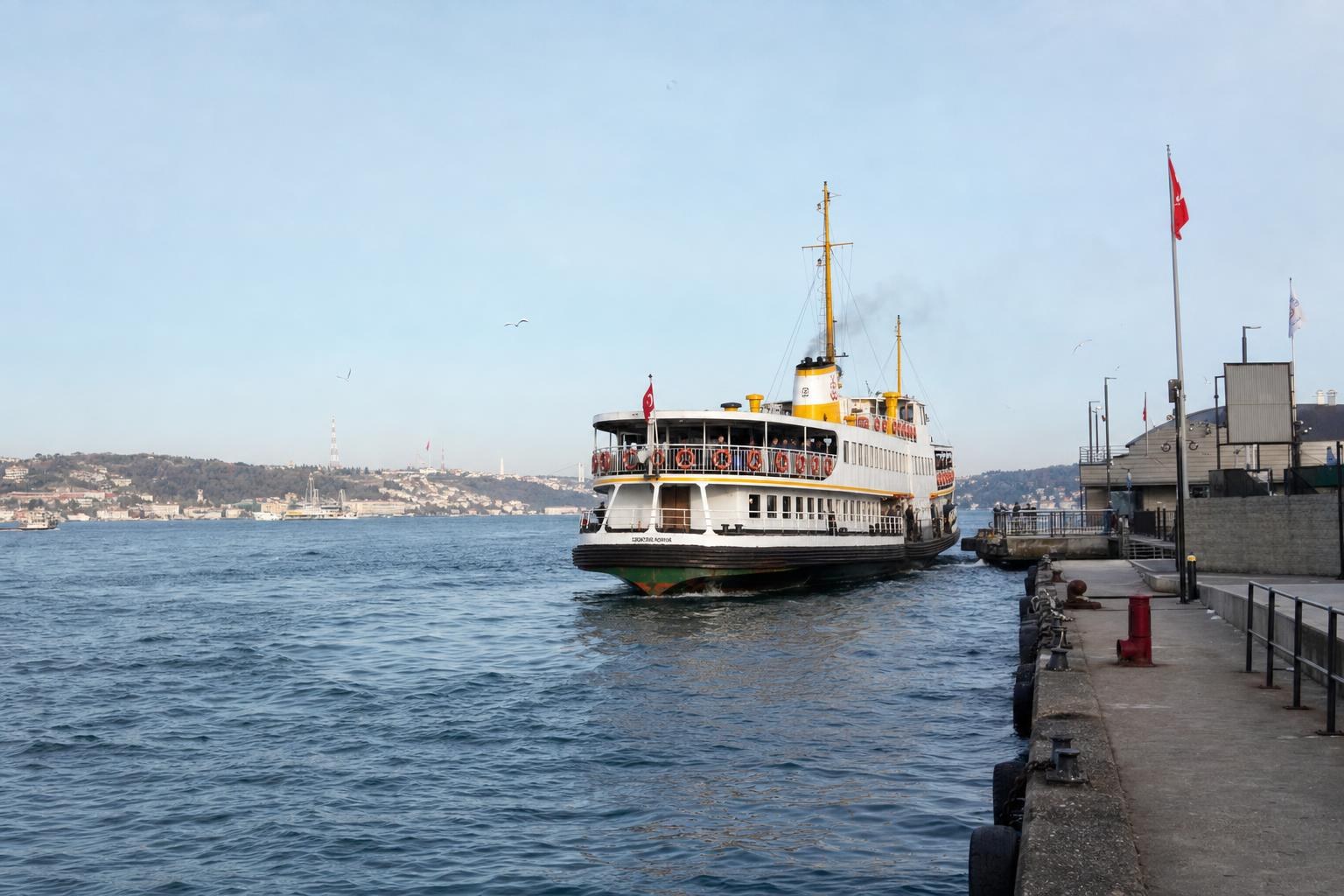
- Ferry Terminal: Karaköy has a major urban ferry terminal with cross-Bosphorus and local services.
- Funicular: Walk towards the nearby Tünel funicular for a short, steep ride towards Beyoğlu and İstiklal Avenue (worthwhile if you wish to explore the hillside).
Source-supported detail: Metro İstanbul documents place both the ferry terminal and T1 tram line within walking distance of Karaköy’s promenade, cementing it as a practical starting point for this route.
Midday: Eminönü and the Galata Bridge — Market Clusters and Transfer Flows
Crossing or taking the tram over the Galata Bridge delivers you into Eminönü—one of Istanbul's oldest marketplace areas and a ripple point for both tourist and local flows.
What to Experience:
- Witness the daily bustle on the Galata Bridge: anglers, mobile fish sandwich stalls, and panoramic views.
- Explore the historic Spice Bazaar (Mısır Çarşısı) and the interconnected hans (old trade courtyards) just behind the waterfront, renowned for their sensory overload of spices, sweets, and textiles.
- Enjoy fish restaurants or grab snacks at the outdoor markets that cluster along the shoreline.
Transfers:
- T1 Tram: Direct stop at Eminönü station.
- Ferry Terminal: Eminönü’s busy terminal feeds European, Asian, and Bosphorus tour ferries.
- Walking: From Eminönü, it’s a short, signposted walk uphill to Sultanahmet’s main squares and monuments.
Source-supported detail: GoTürkiye describes Eminönü’s mesh of bazaars, hans, and terminals; Metro İstanbul’s map shows clear tram/ferry interchange.
Side Note: Accessing Sultanahmet (Historic Peninsula)
The heart of Istanbul’s monumental heritage—including the Blue Mosque and Hagia Sophia—is directly accessible from Eminönü. The T1 tram runs eastward, with the Sultanahmet tram stop just a short ride or a 10–15 minute walk from Eminönü if you want to experience the old city on foot. Sultanahmet’s proximity allows for a flexible detour or focused lunch break, with all major sights signposted from tram and waterfront.
Afternoon: Continue to Beşiktaş — Ferry Hubs and Waterside Promenades
For the most atmospheric Bosphorus transfer, head to Beşiktaş, a vital link in Istanbul’s ferry and tram network.
What to Experience:
- Enjoy the vibrant Beşiktaş ferry square lined with street food, cafés, and everyday local life.
- Take in striking Bosphorus views, particularly as ferries come and go with regular rhythm.
- Visit adjacent parks or explore the bustling market streets and relaxed seafront promenades.
Transfers:
- Ferry: Frequent ferry connections arrive at and depart from Beşiktaş terminal; this includes services from Karaköy and Eminönü, per Metro İstanbul and GoTürkiye official documentation (note: live frequency is not published in the reviewed sources, so check locally before travel).
- Tram/Metro: Beşiktaş is positioned to connect with additional tram lines or the nearby Kabataş–Bağcılar T1 tram’s western terminus, supporting onward journeys into the European and Asian parts of the city network.
Source-supported detail: Metro İstanbul’s official publications designate Beşiktaş as a multi-modal transport terminal with direct onward metro, tram, and bus integration.
Route Planning and Transfer Advice: What’s Supported by Official Evidence
- All tram, funicular, and ferry nodes referenced are specifically mapped and described in Metro İstanbul and GoTürkiye tourism sources.
- While live ferry and tram schedules are not included in the referenced sources, the structural existence of these links and their integration points is repeatedly confirmed in official documentation.
- For trip-day details (latest lines, service adjustments, ticketing), travellers are advised to consult Metro İstanbul’s official website and on-site passenger boards.
Summary Table: Key Stops, Sights, and Transport Links
See the table in the supplementary section for a concise, evidence-based overview.
Final Context: Why This Loop Works for Real-World Visitors
This Bosphorus Edge Loop allows for maximum exposure to Istanbul’s urban shoreline, historic clusters, and daily flows, without being boxed into a purely "old city-only" or single-neighbourhood focus. By using only those modes and interchanges cited in official transit system publications and tourism material, the route is both realistic and flexible—suitable for sightseeing, café stops, and onward exploration.
For timetables and special ferry services, especially on holidays or weekends, always refer to the official Metro İstanbul and city ferry portals on the day you travel.
Key takeaways
- The Bosphorus Edge Loop allows travellers to experience both lively markets and coastal promenades in one route.
- Metro İstanbul’s T1 tram, short funiculars, and city ferries provide a connected, evidence-based itinerary between major neighbourhoods.
- Karaköy, Eminönü, and Beşiktaş each serve as accessible hubs for public transport, sightseeing, and onward connections to other city quarters.
- The route brings together panoramic bridge views, classic market clusters, and relaxed waterfront paths without unnecessary doubling back.
- Official sources confirm all referenced lines and transfer interchanges; always check Metro İstanbul’s website for day-of-travel service updates.
Comparisons & planning
| Neighbourhood | Principal Sight | Tram Line | Ferry Link | Funicular Option | Remarks |
|---|---|---|---|---|---|
| Karaköy | Waterfront, Galataport, Galata Bridge | T1 Kabataş–Bağcılar | Karaköy–Eminönü, Karaköy–Beşiktaş | Tünel Funicular | Main entry point with both tram and ferry integration |
| Eminönü | Spice Bazaar, Markets, Shoreline | T1 Kabataş–Bağcılar | Eminönü–Karaköy, Eminönü–Beşiktaş | None on shoreline | Central transfer and market area |
| Sultanahmet (via Eminönü) | Blue Mosque, Historic Peninsula | T1 Kabataş–Bağcılar | N/A | N/A | Short walk or tram from Eminönü, key monumental zone |
| Beşiktaş | Ferry Terminal, Promenades | Adjacent to T1 / other trams | Beşiktaş–Karaköy, Beşiktaş–Eminönü | Kabataş Funicular nearby | Major Bosphorus hub with onward metro/bus |
Travel checklist
- Download or print the latest Metro İstanbul network map before travel.
- Plan your starting point: Karaköy is convenient for T1 tram and ferry arrivals.
- Familiarize yourself with ferry terminal locations for Eminönü and Beşiktaş using official maps.
- Allocate time for Eminönü’s markets and possible detour to Sultanahmet’s main monuments.
- Check current tram and ferry status on Metro İstanbul’s digital channels or station boards on the day of your visit.
- Wear comfortable shoes—a portion of this loop involves walking between transport nodes and exploring market streets.
Frequently asked questions
Can I complete the Bosphorus Edge Loop with just public transport?
Yes, all segments between Karaköy, Eminönü, and Beşiktaş are connected by public transport services—including the T1 tram, ferry routes, and short funiculars—according to Metro İstanbul and GoTürkiye sources. However, walking between some transfer zones (such as Eminönü to Sultanahmet) is also practical and supported by official guides.
Where do I find the latest schedules for Istanbul's city ferries and trams?
The most up-to-date route information, service changes, and station advisories are published on the Metro İstanbul official website. For ferry timings, check the city ferry portal or inquire at major terminals; the evidence reviewed here confirms the existence and integration of these services, but not live schedules.
Which markets and sights can I visit along this loop?
Key markets include the Spice Bazaar and historic hans of Eminönü; Karaköy’s waterfront and the Galata Bridge; and Beşiktaş’s ferry square and nearby food streets. The Sultanahmet area (Blue Mosque, Hagia Sophia) is directly accessible via short walk or tram from Eminönü.
Is the route suitable for a half-day outing, or should I set aside more time?
The loop is flexible to suit either a brisk half-day or a leisurely full-day excursion. The proximity of major sights, frequent transport links, and compact walking areas allow for a tailored pace, depending on how long you spend in each neighbourhood.
Sources and research notes 2 sources
Based on official source material. Check provider websites for changing visitor details.
Conversation
Sign in or create an account to join the conversation.