Destinations
Heritage Walk in Paris: Île-de-la-Cité, Île Saint‑Louis & the Latin Quarter
Explore the heart of Paris, France with this heritage walking route connecting Île-de-la-Cité, Île Saint‑Louis, and the vibrant Latin Quarter. Featuring UNESCO riverbanks, iconic bridges, literary streets, and practical planning using official resources.
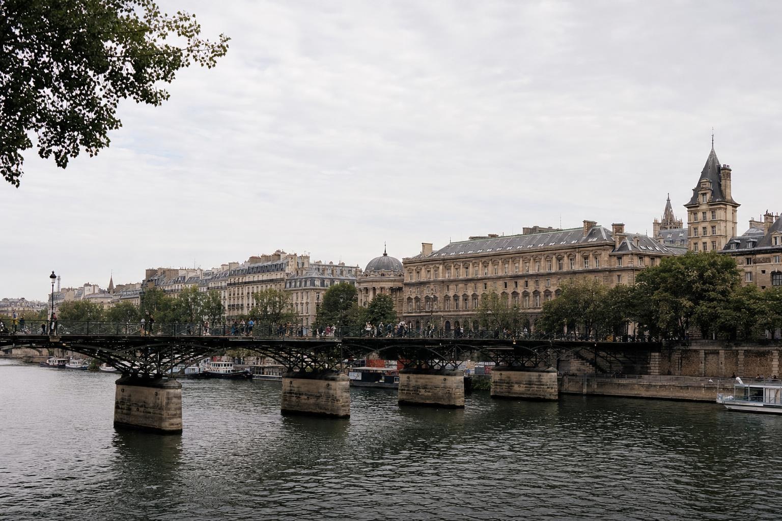
AI illustration · Wardhead AI · AI-generated illustration
Introduction
At the heart of Paris, France, three remarkable districts—Île-de-la-Cité, Île Saint‑Louis, and the Latin Quarter—combine to offer a riverside walking route dense with history, architecture, and literary atmosphere. This itinerary follows the Seine's UNESCO-designated banks, crossing centuries-old bridges and weaving through both monumental and intimate neighbourhoods, all grounded in practical details from official tourism, heritage, and transport sources.
Why Walk This Riverside Route?
Central Paris is defined by the Seine and its islands. The section between Pont de Sully and Pont d’Iéna is recognized as a UNESCO World Heritage site for its exemplary urban landscape and heritage monuments. Île-de-la-Cité stands as the medieval nucleus of the capital, while neighbouring Île Saint‑Louis offers residential quiet with preserved historic character. Crossing to the Left Bank, the Latin Quarter (Quartier Latin) awaits with its maze of literary streets, student energy, and storied cafés—officially described as the city’s academic and cultural heart.
Starting Point: Île-de-la-Cité
Access:
- The only Paris metro station situated directly on an island is Cité (Line 4), as supported by RATP's heritage materials. This station emerges in Place Louis-Lépine, central to the island.
Key Sights:
- Notre-Dame de Paris (noted as an architectural and spiritual landmark).
- Sainte-Chapelle, famous for its medieval stained glass.
- The Conciergerie, a former royal palace lined along the river.
- Place Dauphine, an intimate square framed by facades.
Tip: All these points, including river quays and bridges, are officially named and marked for pedestrian orientation. The western tip, Square du Vert-Galant, provides panoramic Seine views.
Crossing to Île Saint‑Louis
Route:
- Stroll eastward and cross Pont Saint-Louis, a pedestrian bridge connecting the two islands.
Island Character:
- Île Saint‑Louis is praised in city guides for its quiet streets, riverside quays (such as Quai d’Anjou and Quai de Bourbon), and well-preserved 17th-century townhouses.
- The island’s compact layout and pedestrian-friendly bridges make it ideal for slow exploration.
Suggestion: Pause on a quay for riverside scenery—local atmosphere and glimpses back toward Notre-Dame are highlights noted in Paris’s official heritage mapping.
Venture into the Latin Quarter
Access:
- From Pont de la Tournelle or Pont Louis-Philippe, cross to the Left Bank and step into the Latin Quarter. The official Paris tourism site identifies this historic district as a centre for student life and literature.
What to Explore:
- Rue Saint-Jacques (the city’s ancient north-south route).
- Sorbonne university cluster: a renowned educational hub.
- Rue Mouffetard, Rue Monge: meandering pedestrian streets known for markets and cafés.
- Place de la Contrescarpe: lively and historic, surrounded by literary and student hangouts.
Practical Planning Tips:
- Metro stops such as Maubert-Mutualité and Cluny-La Sorbonne (Line 10) are directly in the Latin Quarter.
- City maps and official tourism pages mark major attractions, helping to navigate winding lanes.
- Pedestrian crossings and quays are signposted with blue-and-white direction signs typical in inner Paris.
Optional Extension: Right Bank and Beyond
If time allows, extend your walk north over Pont Neuf to the Right Bank’s Louvre area.
- The Louvre official website gives access directions, visitor services, and museum orientation for continued heritage exploration.
- Alternatively, follow the river’s left bank west past Monnaie de Paris (the historic Paris Mint) towards Pont des Arts, part of the same UNESCO riverfront corridor acknowledged by local planning documents.
Essential Resources & Amenities
Navigational Resources:
- Official place names (such as Pont Neuf, Quai des Grands Augustins, Cité) are consistent across signage and maps.
- RATP, as the public transport operator, provides neighbourhood plans, history, and transport integration for central nodes.
Visitor Services:
- Major monuments (Notre-Dame, Sainte-Chapelle) and museum complexes (the Louvre) publish detailed guidance on amenities and visitor facilities on their official sites.
- For access or service changes, always consult the latest update from attractions or transport authorities shortly before your visit.
Heritage Context: UNESCO Framing
The islands and adjacent banks of Paris are jointly presented by both UNESCO and the City of Paris as a single urban heritage landscape. This underlines the interconnected nature of monuments, bridges, and city life in your walking route.
Summary Checklist for Your Walk:
1. Start at Cité metro station on Île-de-la-Cité for authentic access.
2. Tour key monuments using official signage and map points.
3. Cross to Île Saint‑Louis for a quieter, lived-in island experience.
4. Use Pont de la Tournelle or Pont Louis-Philippe to enter the Latin Quarter.
5. Explore Rue Mouffetard, Place de la Contrescarpe, and Sorbonne areas per Paris tourism recommendations.
6. For onward exploration to the Louvre or Eiffel Tower corridor, consult respective official access maps.
If details such as live service status or access restrictions are needed, these must be checked directly with the relevant official resources as cited below.
Key takeaways
- The central Seine riverbanks in Paris, France are a UNESCO World Heritage site, providing a unique backdrop for a self-guided walk.
- Île-de-la-Cité is the historic core of Paris and offers direct metro access via Cité station.
- Île Saint‑Louis is renowned for quiet quays and preserved architecture ideal for relaxed exploration.
- The Latin Quarter is a vibrant, academic, and literary district, famous for its pedestrian streets and atmospheric cafés.
- Official Paris tourism, museum, and public transport sites provide reliable resources for route planning and live updates.
Comparisons & planning
| Place/Stop | District | Type | Official Relevance | Nearby Official Resource | Primary Access |
|---|---|---|---|---|---|
| Cité Metro Station | Île-de-la-Cité | Transport | Unique metro access to the island | RATP station page | Line 4 |
| Notre-Dame de Paris | Île-de-la-Cité | Monument | Architectural and civic landmark | Paris tourism | Pedestrian |
| Pont Saint-Louis | Île-de-la-Cité/Île Saint‑Louis | Bridge | Pedestrian link between islands | City map | On foot |
| Place Dauphine | Île-de-la-Cité | Square | Historic public space | Paris tourism | Pedestrian |
| Rue Mouffetard | Latin Quarter | Street | Popular for markets/cafés | Paris tourism | Pedestrian |
| Place de la Contrescarpe | Latin Quarter | Square | Lively, historic literary hub | Paris tourism | Pedestrian |
Travel checklist
- Begin your walk at Cité metro station (Line 4) on Île-de-la-Cité.
- Visit Notre-Dame de Paris, Sainte-Chapelle, and the Conciergerie on the island.
- Cross Pont Saint-Louis to explore the quieter Île Saint‑Louis.
- Rest along quays such as Quai d’Anjou or Quai de Bourbon.
- Enter the Latin Quarter via Pont de la Tournelle or Pont Louis-Philippe.
- Follow signposted pedestrian routes to the Sorbonne, Rue Mouffetard, and Place de la Contrescarpe.
- Consult official attraction and RATP resources for updated visitor and access information.
Frequently asked questions
Is the entire riverside walking route accessible to pedestrians?
Yes, the official city maps and signage indicate continuous pedestrian quays, bridges, and streets between Île-de-la-Cité, Île Saint‑Louis, and the Latin Quarter. These areas are designed for foot traffic with well-marked crossings, especially around the UNESCO-listed riverbanks.
How do I use public transport to reach the starting point?
Cité (Line 4) is the only Paris metro station situated directly on an island, making it the most convenient entry for Île-de-la-Cité. Official RATP maps and heritage pages provide detailed station information and neighbourhood context.
What official resources should I use for live transport or service status?
Use the official RATP website for real-time transport updates, and check specific museum or attraction pages for live visitor information regarding services, hours, and any access restrictions.
Are there official guides or maps for this walking itinerary?
Official Paris tourism and municipal websites offer printed and digital maps marking the islands, bridges, and main points of interest, making route planning straightforward with reliable waypoints.
Has anything here changed?
Help us keep these practical details accurate.
Sources and research notes 5 sources
Based on official source material. Check provider websites for changing visitor details.
Conversation
Sign in or create an account to join the conversation.