Travel tips
Staying by the Bosphorus: Neighbourhood and Transport Choices for Waterside-Focused Stays in Istanbul, Turkey
This guide helps travelers choose where to stay in Istanbul for maximum Bosphorus enjoyment, comparing major waterfront neighbourhoods on both European and Asian shores, and explaining public transport links between the water and the city’s main attractions. Sourced from official Turkish tourism and Istanbul metro pages.
AI illustration · Wardhead AI · AI-generated illustration
Introduction
The Bosphorus Strait is the heart of Istanbul, Turkey—a linear cluster of sights, historic piers, and atmospheric promenades that shapes how visitors experience the city. Choosing accommodation along the Bosphorus brings the opportunity for scenic ferry rides, evening walks by the water, and quick access to both European and Asian neighbourhoods. However, the mix of historic, cultural, and leisure districts—and the patchwork of trams, metros, and ferries—means selecting the right neighbourhood is essential for a waterside-focused stay. This guide uses official Istanbul destination listings and the Metro İstanbul system to outline key neighbourhoods, their amenities, and the public transport connections that affect your daily plans.
European Shore Basins: Eminönü, Sultanahmet, Beyoğlu, Karaköy, and Beşiktaş
Eminönü and Sultanahmet
This area forms the southern gateway to the Bosphorus and is rich in landmark attractions: Hagia Sophia, Topkapı Palace, and the Grand Bazaar all sit within easy walking distance inland from Eminönü’s busy ferry piers. Staying here means you can reach the core Sultanahmet sites as well as the main Bosphorus and Golden Horn ferry routes just minutes from your door. Eminönü and the adjacent Kabataş are also served by major rail links—including tram lines and funiculars—that connect them to different city districts. These routes and connections appear in detail in official Metro İstanbul network maps, helping you locate accommodation with the shortest walks to ferry or tram stops.
Beyoğlu, Karaköy, and Galata
Beyoğlu is highlighted in official sources as a cultural and nightlife hub, just northwest of the Historic Peninsula and one block inland from the mouth of the Bosphorus. Karaköy provides immediate waterside access, modern ferry piers, and links to the Galataport development. The neighbourhood’s catalogue of cafés, pedestrian avenues, and artistic venues makes this area ideal for evening strolls along historic streets, with easy transfers to both trams and the T1 tram line (linking the district to Sultanahmet, Eminönü, and beyond). The Tünel funicular connects Beyoğlu, Karaköy, and uphill areas efficiently—use the Metro İstanbul maps to visualise how accommodation links to these nodes for quick river- and rail-based commutes.
Beşiktaş to Ortaköy and Levent
Stretching north along the European shore, Beşiktaş and Ortaköy offer a rich selection of waterfront cafés, fishing piers, and Bosphorus cruises. Beşiktaş in particular serves as a major ferry hub, as referenced in Istanbul’s official destination listings. Accommodation here offers evening access to a thriving Bosphorus scene and fast connections to inland districts via surface buses and metro lines. Levent, one of Istanbul’s main business quarters, is set slightly inland but provides rapid metro access to the whole city. To weigh a direct waterside feel against speedy inland movement, check Metro İstanbul’s official network map for the closest metro/tram lines to your preferred neighbourhood and property.
Asian Shore Highlights: Kadıköy, Moda, Üsküdar, and Beylerbeyi
Kadıköy and Moda
Kadıköy, highlighted for its lively mix of markets, coastal promenade, and commuter and leisure ferry services, anchors the Asian side. The adjacent Moda neighbourhood extends this offering with laid-back streets and relaxed waterside vibes. Official sources describe Kadıköy as both a major ferry hub (for both cross-continental and local ferries) and a transport interchange point: the M4 metro line, for instance, links Kadıköy directly to Sabiha Gökçen Airport and other eastern districts. For rapid connections across the city and direct access to Bosphorus ferries, use operator maps to confirm walking distances from potential hotels to major ferry, metro, or tram stations.
Üsküdar and Beylerbeyi
North of Kadıköy, Üsküdar and the more tranquil Beylerbeyi offer a calm Bosphorus experience, featuring historical mosques, palaces, and parks facing Europe’s skyline. Üsküdar’s busy ferry pier connects to multiple European districts—including Eminönü and Beşiktaş—useful for daily commutes or sightseeing. Metro/tram network maps from Metro İstanbul can identify the best stations for transfers between rail and ferry in this stretch—helping you plan access to both Asian and European highlights.
Princes’ Islands: A Waterside Alternative
The Princes’ Islands (including Büyükada and Heybeliada) offer a distinct experience—official destination references group these as tranquil getaways prioritised for relaxation over fast city connectivity. Sea links from both European and Asian ferry piers provide access, but ferry timetables are not detailed on Metro İstanbul or GoTürkiye’s referenced pages. If island tranquillity is your focus, check ferry operator schedules directly for up-to-date departure points and frequencies.
Comparing Neighbourhood Ambiance, Transport, and Trade-offs
The Bosphorus’s immediate neighbourhoods (Karaköy, Ortaköy, Bebek, Kadıköy) maximise your ability to catch ferries, enjoy evening walks, or relax in cafés beside the water. However, they sometimes demand longer walks or an additional transfer to reach the main metro lines that cut through inland Istanbul—central commercial and accommodation hubs like Levent or Şişli offer faster citywide rail journeys, but are about a neighbourhood away from the water. When shortlisting a hotel or apartment, consult Metro İstanbul’s maps and official line pages to determine walking or tram/funicular distances to both waterfront piers and major metro stations.
Ferry Piers as Mobility Hubs
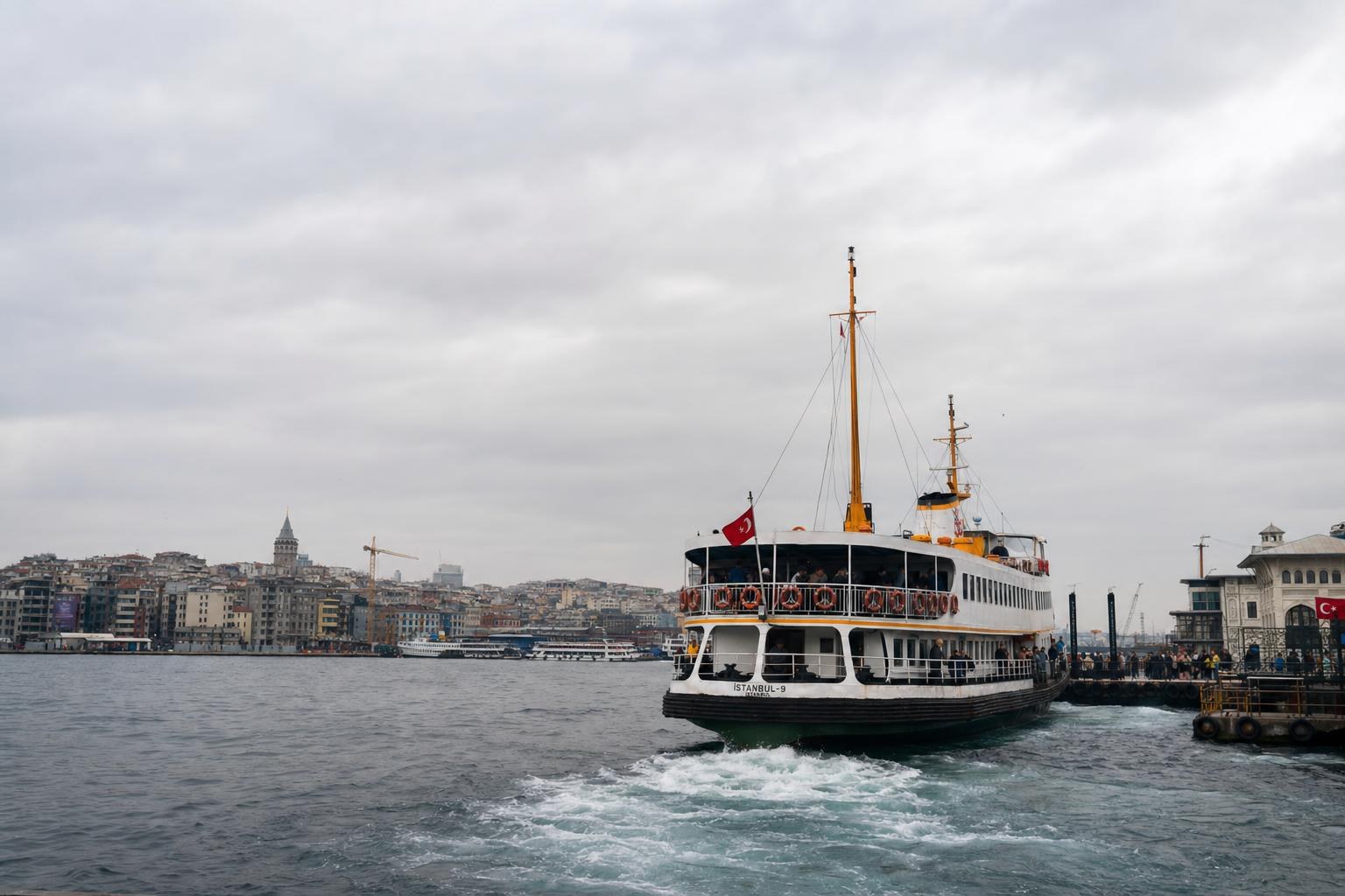
Eminönü, Kabataş, Beşiktaş, Karaköy, Kadıköy, and Üsküdar act as essential multimodal junctions, connecting cross-continental ferry services with inward rail and tram transport. Metro İstanbul’s network maps illustrate how T1/T2 trams, funicular lines, and select metro lines interface with these nodes—critical information for planning scenic commutes or evening ferry jaunts. However, information about specific ferry frequency or seasonality is incomplete on the main transport and tourism sites referenced—you may wish to consult ferry operator or port authority pages for the latest detailed schedules.
Metro, Tram, and Funicular Network Planning
Metro İstanbul’s official homepage and network map provide an up-to-date overview of operational metro, tram, funicular, and cable car lines, including line names (e.g., M1–M9, T1–T5) and the key interchange points that define efficient crosstown movements. If your waterside ambitions are paired with a need for rapid metro travel (for airport runs or urban business visits), check these maps and line pages to ensure your accommodation is close to both water and rail nodes. Newly commissioned lines and changes appear under the operator’s “Announcements” or “Lines” pages—worth consulting if ease of movement is essential.
Practicalities and Gaps in Evidence
While official sources comprehensively present the city’s rail and tram network, along with destination highlights by neighbourhood, detailed ferry timetables and seasonal schedules are not always provided. For the most nuanced planning—especially if focusing on island excursions or timing-dependent ferry commutes—direct consultation of ferry operator or port authority sites is advised, as this information was not available in the official tourism or Metro İstanbul sources used here.
Conclusion
Choosing a Bosphorus-facing neighbourhood in Istanbul offers remarkable access to the city’s scenic heart, but practical enjoyment depends on how well your chosen accommodation connects to public transport nodes—especially ferries and metro lines. Using the official destination listings and Metro İstanbul’s maps, you can optimise for evening waterfront ambiance, easy intercontinental commutes, or a balance of rail and ferry mobility. For visitors keen on a waterside-focused stay, checking property locations against the official network ensures each day begins and ends by the Bosphorus.
Key takeaways
- Staying near the Bosphorus offers immediate waterfront access and scenery, but proximity to efficient public transport is key to maximising your stay.
- Neighbourhoods like Beyoğlu, Karaköy, Beşiktaş, Kadıköy, and Üsküdar balance ferry and rail access for easy movement across both city shores.
- Metro İstanbul's official maps help pinpoint locations with easy transfers between metro, tram, and ferry—essential when choosing accommodation.
- For dedicated island or ferry-focused plans, consult ferry operator schedules directly, as not all service details are on tourism or metro sites.
Comparisons & planning
| Neighbourhood | Atmosphere | Waterfront Access | Rail/Tram Proximity | Key Ferry Pier | Cited Source |
|---|---|---|---|---|---|
| Eminönü/Sultanahmet | Historic core, walkable to landmarks | Immediate ferry/Golden Horn piers | Tram & funicular lines | Eminönü | GoTürkiye |
| Beyoğlu/Karaköy | Cultural hub, nightlife, arts | Direct to Bosphorus at Karaköy | T1 tram, funicular | Karaköy | GoTürkiye |
| Beşiktaş/Ortaköy | Lively cafés, local scene | Central Bosphorus piers | Bus, nearby metro | Beşiktaş | GoTürkiye |
| Kadıköy/Moda | Asian-side, markets, relaxed promenades | Extensive coastal promenade | Metro M4, tram links | Kadıköy | GoTürkiye/Metro İstanbul |
| Üsküdar/Beylerbeyi | Neighbourhood parks, palaces, calm | Historic piers & Bosphorus mosques | Ferry, bus, metro | Üsküdar | GoTürkiye |
| Princes’ Islands | Tranquil, car-free, green | All waterside | Ferry only (no rail) | Büyükada | GoTürkiye |
Travel checklist
- Shortlist hotels or rentals near major ferry piers: Eminönü, Karaköy, Kabataş, Beşiktaş, Kadıköy, Üsküdar.
- Check Metro İstanbul network maps for the nearest tram, metro or funicular station to your accommodation.
- Consider evening access to waterfront cafés and promenades when evaluating neighbourhoods.
- Consult official line announcements for newly opened metro stations or changes near your target area.
- For island stays, verify ferry departure points and schedules on ferry operator or port authority websites.
- Factor in walking distances between your accommodation, public transport nodes, and the actual shoreline.
Frequently asked questions
Which neighbourhoods in Istanbul have the easiest access to Bosphorus ferries?
Eminönü, Karaköy, Beşiktaş, Kadıköy, and Üsküdar are the main neighbourhoods with direct ferry piers, offering easy transit across the Bosphorus and along both shores according to official Istanbul destination and transport maps.
How do I check if my accommodation is near a metro or tram station in Istanbul?
Use the official Metro İstanbul network maps or line pages to identify nearby stations relative to your accommodation. This helps ensure easy transfers between rail, tram, and ferry services.
What is the main transport trade-off when staying along the Bosphorus?
Neighbourhoods closest to the water maximize evening scenery and ferry access but may require longer walks or transfers to reach Istanbul's main metro lines. Inland hubs offer faster metro access but are further from the waterfront.
Where can I find up-to-date ferry schedules for Istanbul?
Ferry timetables and seasonal frequency are not provided on Metro İstanbul or GoTürkiye’s referenced pages. For the latest details, consult the websites of the ferry operators or the port authority directly.
Sources and research notes 2 sources
Based on official source material. Check provider websites for changing visitor details.
Conversation
Sign in or create an account to join the conversation.