Travel tips
Getting Around New York City, United States: A Guide to Public Transport
Explore New York City’s extensive public transport network—subways, buses, ferries, and more—with this factual guide. Learn how to navigate, plan, and access key resources for efficient, accessible, and multi-borough travel.
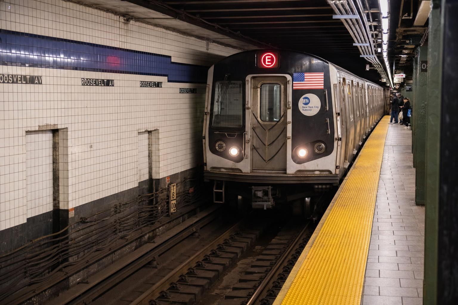
AI illustration · Wardhead AI · AI-generated illustration
Getting Around New York City, United States: A Guide to Public Transport
New York City’s unique energy is powered in part by an immense public transport system connecting all five boroughs—Manhattan, Brooklyn, Queens, The Bronx, and Staten Island. Whether you’re planning a visit or navigating daily life, understanding how to access and use these transit options can help you explore with confidence. This guide reviews the main networks, planning resources, accessibility initiatives, and useful navigation tools available directly from official sources.
Overview: Operators and Core Networks
The backbone of New York City public transport is the Metropolitan Transportation Authority (MTA). Through its New York City Transit operations, the MTA runs the city’s subways, local and limited-stop buses, and the Staten Island Railway. The MTA also publishes official route maps and planned service change information, which are critical for all travelers and commuters. Additional city partnerships and visitor resources highlight ferries—operated by various public and private entities—as important connectors, especially along the waterfront and between boroughs.
Navigating the Subway System
The subway remains the primary means of getting around much of the city. The MTA provides two main types of official subway maps: a schematic design for easy route visualization and a geographic map highlighting spatial relationships, helping riders orient themselves in relation to neighborhoods, express/local lines, and station features. These maps are offered as downloadable PDFs, pocket-sized versions, and accessible large-type editions. For planning purposes, each station is clearly marked with symbols denoting accessibility features, transfer points, and service patterns.
Supplementing the subway maps, the MTA also produces neighborhood-based station-area diagrams. These detailed maps are especially useful when you exit at an unfamiliar stop, summarizing nearby streets, connecting bus routes, and highlighting points of interest within walking distance. PDFs of these neighborhood maps can be found via the MTA’s official site and are recommended for anyone planning to explore beyond Manhattan’s core.
Bus Network and Local Access
The city’s bus network—also operated by the MTA—covers streets and neighborhoods that the subway does not reach directly. Within each borough, local and limited-stop bus routes provide crucial links to educational institutions, hospitals, shopping areas, and residential communities. To identify the best connections, official MTA resources supply both citywide bus maps and station-specific neighborhood PDFs showing exactly which lines serve any given area.
For visitors and residents alike, integrating bus and subway travel can greatly expand the range of accessible destinations. Because street-level navigation can vary significantly between boroughs, neighborhood maps showing where the nearest bus stops are, along with nearby subway entrances and exits, are especially helpful for seamless transfers.
Accessibility Initiatives and Rider Tools
The MTA continues to expand accessibility throughout its system. Many stations are being upgraded or have recently added features such as elevators, ramps, tactile graphics, and enhanced signage. Innovative pilot programs like the Accessible Station Lab trial adaptive wayfinding tools and smartphone-friendly navigation for travelers with disabilities.
Official MTA subway maps and online station-finder tools indicate updates to accessibility, including new stations that are step-free or that have advanced navigation options. For travelers with specific mobility needs, consulting these resources before your trip will help you identify which stations are suitable for your journey. For up-to-date information on new accessible stations, the MTA regularly issues mapped updates and dedicated web pages.
Planned Service Changes and Real-Time Planning
The sheer scale of New York’s public transit system means maintenance and service adjustments are frequent. The MTA’s “Planned Service Changes” online portal is the official source for information on scheduled work, reroutes, and alterations to subway, bus, and Staten Island Railway service. Checking this resource before traveling—even on weekends and holidays—is strongly advised, as changes may impact routing across all boroughs.
Performance dashboards published by the MTA offer snapshots of systemwide operations, ridership statistics, and overall service levels. While these dashboards are useful for context, all real-time status checks and up-to-date route information should be taken from the official planned service and accessibility status pages provided by the MTA.
Ferries and Waterfront Travel
Ferries form an integral part of New York City’s public transport mix, enabling quick and scenic trips between boroughs like Manhattan, Brooklyn, Queens, and Staten Island. NYC Ferry and the Staten Island Ferry are both referenced in official tourism and transit guides as public-transport options for visitors and residents. Ferries are particularly useful for accessing waterfront neighborhoods, parks, and events, as well as offering unique vantage points for the city’s skyline.
Not all ferry routes are operated by the MTA; to find out about schedules, routes, docks, and fares, consult the dedicated operator websites. If you’re planning to use a ferry to reach an event or a specific neighborhood, city tourism pages also publish lists of current services and seasonal schedule changes.
Airport Transit Connections
Major New York City airports are directly linked to the city by a combination of public buses, subways, and commuter rail routes. Official tourism sources describe these connections as standard options for both arriving visitors and locals leaving town. Guidance emphasizes the use of public buses and rail lines for reliable access, but advises consulting the respective transport operators for current routing, as service patterns can shift. For planning your airport trip, cross-check the latest transfer options from both the MTA and your airport’s official information pages.
Travel During Major Events and Crowds
Large-scale events—such as international sporting tournaments or citywide festivals—routinely draw increased crowds and demand special transit arrangements. New York City’s destination-marketing and tourism organizations, in collaboration with the MTA and other transit operators, coordinate additional bus shuttles and service enhancements for these occasions. If your visit aligns with a major event, check both the city’s official event sites and MTA operator updates for the latest on travel advisories and special schedules.
Practical Planning for Your Visit
- Always download or reference the latest MTA subway and bus maps before your trip to get a clear sense of your route.
- Use neighborhood-specific station PDFs for reliable orientation upon exiting to street level, especially outside Manhattan.
- For travelers with mobility or sensory needs, check the MTA’s dedicated accessibility updates and lab program details before setting out.
- Confirm any planned service changes or maintenance on your planned travel date using the MTA’s official portal.
- For waterfront or borough-to-borough travel, consult both city tourism and ferry-operator sites for up-to-date route and stop lists.
New York City’s public transport network is vast, adaptive, and open to visitors year-round. Using official, up-to-date resources in your planning ensures a smoother experience, whether you’re exploring classic attractions or new neighborhoods in all five boroughs.
Key takeaways
- The MTA operates New York City’s subway, local buses, and the Staten Island Railway.
- Official subway and neighborhood maps from the MTA are essential for trip planning and on-the-ground navigation.
- Accessibility upgrades are ongoing; check MTA sources for the most current information on station features.
- NYC Ferries connect waterfront neighborhoods and serve as a scenic public-transport option.
- Subway, bus, and rail transfers can connect most neighborhoods, but planned service changes may affect travel.
- Consult official MTA and city tourism websites before traveling, especially during major city events.
Comparisons & planning
| Mode | Operator | Area Served | Planning Resource | Accessibility Info |
|---|---|---|---|---|
| Subway | MTA NYC Transit | All boroughs | MTA subway maps, neighborhood PDFs | Accessibility symbols on maps and dedicated pages |
| Buses | MTA NYC Transit | All boroughs (local & limited-stop) | MTA bus maps and station area PDFs | Accessibility info on MTA site |
| Staten Island Railway | MTA NYC Transit | Staten Island | MTA SIR maps | MTA accessibility updates |
| NYC Ferry | Various public/private | Waterfront boroughs | Official ferry operator pages | Contact operator for details |
| Airport Transit Links | MTA & others | JFK, LaGuardia, Newark | Airport and MTA websites | Operator-specific |
Travel checklist
- Download up-to-date MTA subway and bus maps before your trip.
- Review neighborhood station-area PDFs for local orientation.
- Verify accessible station features relevant to your needs using MTA resources.
- Consult the MTA’s planned service changes page before traveling.
- Check ferry operator websites for current routes and stops.
- Plan for additional crowd management and service changes during major events.
Frequently asked questions
Where can I find official subway and bus maps for New York City?
Official MTA subway and bus maps, including neighborhood-specific PDFs, are available at the MTA website’s map section.
How can I check if a station in New York City is accessible?
Use the MTA’s online accessibility pages and subway maps, where accessible stations are clearly marked with dedicated symbols.
Are ferries part of New York public transport, and do they connect different boroughs?
Yes. Ferries, including NYC Ferry and Staten Island Ferry, connect various waterfront neighborhoods across the boroughs. Always check each ferry operator’s official website for the latest information.
How do I know if there are planned service changes during my visit?
Consult the MTA’s official 'Planned Service Changes' page for scheduled maintenance, reroutes, or alterations to service before you travel.
Sources and research notes 4 sources
Based on official source material. Check provider websites for changing visitor details.
Conversation
Sign in or create an account to join the conversation.