Travel tips
Bangkok, Thailand: A Practical Guide to Getting Around and Public Transport
Discover how to navigate Bangkok’s bustling city using its BTS Skytrain, MRT subway, Airport Rail Link, river ferries, and BMA shuttle networks. This guide offers verified details on modes, key areas, recent upgrades, and practical planning tips for efficient travel through Thailand’s vibrant capital.
AI illustration · Wardhead AI · AI-generated illustration
Bangkok, Thailand’s colossal capital, offers visitors endless possibilities for exploration—ancient temples stand beside glitzy malls, and hidden markets pop up between skyscrapers. Covering such a dynamic city is made achievable thanks to a multi-layered public transport network. This guide outlines the officially documented ways to get around Bangkok, giving you trusted, practical advice for efficient, flexible and memorable city travel.
Main Public Transport Modes in Bangkok
BTS Skytrain (Elevated Rail)
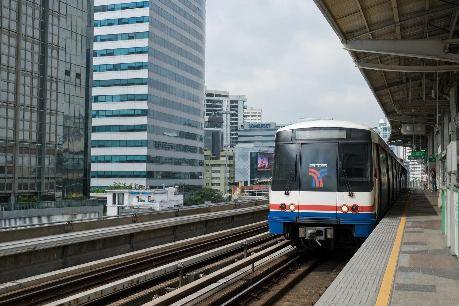
Bangkok’s BTS Skytrain—often simply called "BTS"—forms a backbone of elevated rapid transit, running through the city’s core districts. Official municipal maps show the BTS serving Siam, Silom, Sathorn, and Asok—areas packed with shopping, business, and entertainment (webportal.bangkok.go.th ↗). Interchange stations such as Siam and Asok facilitate transfers to other rail lines, and many offer elevated views of busy urban corridors.
MRT (Metro/Subway) and Airport Rail Link (ARL)
The Metropolitan Rapid Transit (MRT) links central Bangkok with outer suburbs, complementing the BTS and further broadening rail access (invest.bangkok.go.th ↗). Several colour-coded lines cover a wide geography and connect key destinations via convenient interchange stations.
The Airport Rail Link (ARL) is the principal direct rail link between Suvarnabhumi Airport and downtown. From ARL’s Phaya Thai terminus, travelers can switch to the BTS, and from Makkasan, to the MRT, ensuring fast, direct access to much of the city (tourismthailand.org ↗).
Chao Phraya River Ferries
The Chao Phraya River remains a vital transport corridor as well as a scenic highlight. Regular river ferry services connect both sides of the river, with stops at major piers next to the Grand Palace, Wat Pho, Wat Arun, and more (tatnews.org ↗, tatnews.org ↗). Official sources note the introduction of electric, air-conditioned ferries, improving comfort and sustainability while delivering direct access to riverside attractions and new perspectives of Bangkok’s historic core.
BMA Feeder Buses and Shuttles
Outside the city centre and main rail alignments, the Bangkok Metropolitan Administration (BMA) runs a network of feeder bus and shuttle routes. These crucial services link neighborhoods and outer districts—including major community markets—to key MRT and BTS stations, as mapped and listed on official city portals (greener.bangkok.go.th ↗). They’re especially useful for visiting vibrant weekend markets or outer-area attractions without relying on private taxis.
Key Corridors and Area-Specific Planning
Central Business Districts (Siam, Silom, Sathorn, Asok)
Bangkok’s busiest commercial and entertainment districts are best reached by the BTS Skytrain. Districts like Siam and Asok are directly served by stations positioned at route interchanges, giving travelers access to malls, offices, and dining. Siam station offers particularly effortless transfers between BTS lines and convenient access to major shopping hubs (webportal.bangkok.go.th ↗).
Historic Riverside (Rattanakosin, Grand Palace, Wat Arun)
To reach Bangkok’s historic heart—the Grand Palace, riverside temples, and museums—river ferries are the preferred official option. Piers such as Tha Chang, Tha Tien, and Wat Arun provide direct pedestrian access to the city’s most iconic cultural sites (tatnews.org ↗). River travel is recommended for experiencing heritage districts, as well as for enjoying river views and breezes en route.
Community Markets and Outer Districts
Bangkok’s extensive market scene—especially open-air and weekend markets—often lies beyond immediate rail service. The BMA coordinates shuttle and feeder bus lines specifically to link such destinations (documented on their open-data maps) to the urban rail and metro networks (greener.bangkok.go.th ↗).
Airport Transfers
Travelers flying into Suvarnabhumi Airport are best served by the Airport Rail Link, which connects directly with the city’s BTS and MRT lines. This avoids road congestion and streamlines onward access to main hotel, shopping, and tourist districts (tourismthailand.org ↗).
Recent Developments and Initiatives
Sustainable Upgrades and Expansions
Electric, air-conditioned ferries are now operating on the Chao Phraya River, improving both comfort and air quality over traditional boats (tatnews.org ↗). Meanwhile, official city masterplans call for ongoing expansion of rail corridors and increased integration among transport modes, part of Bangkok’s broader aims for sustainability and urban development (climatechange.bangkok.go.th ↗).
Authorities and Operators to Know
- Bangkok Metropolitan Administration (BMA): Oversees municipal services, publishes feeder/shuttle info, and manages open-access city data.
- BTS (Skytrain): Runs the principal elevated rail system serving core Bangkok.
- MRT: Responsible for the metro and subway network.
- Tourism Authority of Thailand (TAT): The primary national tourism body; issues official guidance on river travel and new service launches.
Essential Planning Tips
- Use BTS and MRT to travel quickly within core business, shopping, and hotel zones—especially during peak highway congestion.
- When exploring historic riverside sites, ferries are the most direct, atmospheric, and sustainable route; check which piers are nearest intended stops.
- For markets or communities outside main rail corridors, plan via BMA’s feeder/shuttle listings for direct connections.
- For latest schedules and exact fares, consult operator websites or ask at station counters—official city and tourism pages give overviews, but not real-time details.
What Remains Unverified
Some practical traveler questions—such as current train or ferry fares, exact timetable details, or accessibility per station—could not be confirmed in official city or tourism summaries. For these, direct operator or station inquiry is needed before your trip.
Glossary
- BTS: Bangkok Mass Transit System (Skytrain; elevated urban rail)
- MRT: Metropolitan Rapid Transit (metro/subway)
- ARL: Airport Rail Link (connects Suvarnabhumi Airport with inner Bangkok)
- Chao Phraya Ferries: Public and privately run river boats, including eco-friendly electric ferries
By leveraging Bangkok’s integrated public transport, travelers can skip the city’s notorious traffic and reach both glittering new districts and serene old quarters. Using official maps and a bit of up-to-date checking before you go, you’ll find both convenience and character in every metre of the city.
Sources and research notes 7 sources
Based on official source material. Check provider websites for changing visitor details.
Conversation
Sign in or create an account to join the conversation.