Itineraries
Waterfront Neighbourhood Slow-Travel: A Brooklyn Heights → DUMBO Promenade Route (New York City, United States)
Explore Brooklyn Heights and DUMBO on foot with this slow-travel itinerary. Wander historic brownstone streets, stroll the Brooklyn Heights Promenade for iconic river views, and soak up DUMBO’s creative riverside atmosphere—ideal for relaxed discovery and photography. This guide helps you link these distinctive New York City neighborhoods with easy walking and clear public transit access.
AI illustration · Wardhead AI · AI-generated illustration
Introduction
Brooklyn's riverfront offers more than just skyline views—it’s the perfect place for a slow neighbourhood walk linking two of New York City’s most atmospheric areas. This itinerary guides you from the mellow streets of Brooklyn Heights, with its tree-lined blocks and heritage brownstones, to the creative energy of DUMBO’s cobblestone lanes and riverside vistas. Designed for slow exploration and relaxed discovery, this route makes it easy to enjoy architecture, local viewpoints, riverside photography, and the distinctive character of each neighbourhood. All recommendations are grounded in official tourism and transit sources.
Getting Oriented: How the Neighbourhoods Connect
Brooklyn Heights and DUMBO form a logical, walkable cluster along Brooklyn’s northwest waterfront. The neighborhoods are linked by both surface streets and promenades—making for continuous walkable public space ideal for unhurried travel. Official mapping shows that subway stations and sidewalks connect directly to riverfront promenades, offering multiple flexible starting points and allowing travellers to arrive via public transit without difficulty.
Day 1: Brooklyn Heights and the Promenade
Start your slow-travel route in Brooklyn Heights, an official historic district known for its intact 19th-century architecture and impressive cityscape vistas. As per NYC’s official tourism information, the area is renowned for its tree-lined residential streets and brownstone facades. A leisurely stroll along Montague or Pierrepont Streets—both lined with classic architecture—gives an immediate sense of Brooklyn’s urban heritage.
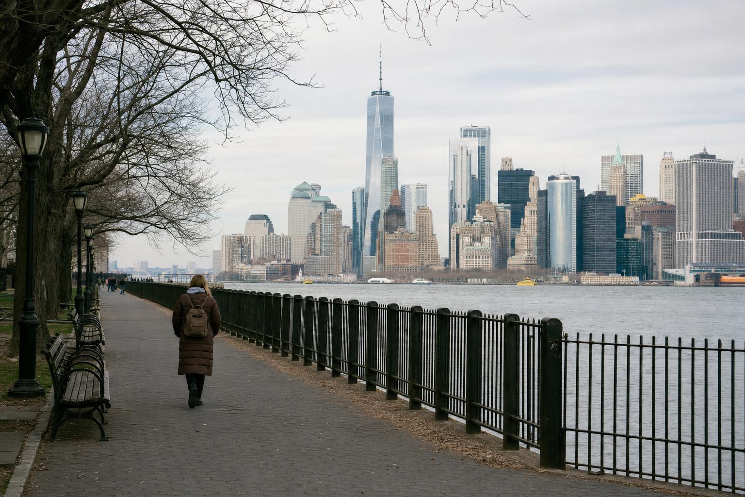
Your prime destination here is the Brooklyn Heights Promenade, a highly celebrated public esplanade elevated above the East River. According to official neighbourhood guides, the promenade stretches along the river’s edge and provides unmatched views of the Manhattan skyline, the Brooklyn Bridge, and the waters below. It’s one of New York’s best-known walking routes for both locals and visitors seeking big-sky perspective, comfortable benches, and a car-free environment for photos or reflection.
For a classic experience:
- Access the Promenade from Montague, Clark, or Remsen Streets—each leads directly to the esplanade’s top edge. Take advantage of the continuous sidewalk system as mapped by the MTA for safe and pleasant walking.
- Pause for photos at the viewing platforms: the most famous vistas are at the Montague Street entrance and the midsection overlooking Manhattan’s towers and the Brooklyn Bridge.
- Enjoy the leafy calm. This is a quiet, residential area—ideal for a morning or sunset stroll.
At your own pace, explore the network of short, grid-like blocks surrounding the Promenade. The historic district status, as mapped and described by the National Park Service, means you’ll be surrounded by a consistent architectural character. (The district’s precise boundaries and historical notes are documented in federal records; look for brownstone address plaques and period streetscapes.)
Day 2: Down to DUMBO—Riverside Lanes and Creative Energy
From the southern end of the Promenade, head north or northwest towards DUMBO—short for Down Under the Manhattan Bridge Overpass. Official tourism content highlights DUMBO as Brooklyn Heights’ immediate neighbour, continuing the riverside experience beneath the Brooklyn and Manhattan Bridges. This area blends restored industrial warehouses and cobblestone streets with art galleries, local cafes, and sweeping riverside walkways.
For a relaxed exploration:
- Use the walking paths noted in official city and transit maps; these connect the Promenade’s lower end to DUMBO via Everit Street, Old Fulton Street, or the approach ramp from Brooklyn Bridge Park.
- Take your time in Brooklyn Bridge Park, a riverside green space that links the two neighbourhoods and offers open lawns, playgrounds, and seating. While not specifically detailed in the cited sources, park paths are clearly marked on official maps and connect directly to DUMBO’s main lanes.
- In DUMBO, explore Washington Street and Water Street for classic bridge-framed photographs—these sites are well-known from visitor guides and offer dramatic views through the massive piers of the Manhattan Bridge to the city beyond.
- Enjoy DUMBO’s industrial-to-creative transformation. Many riverside buildings now house cafes, galleries, and design studios, making this area a hub for relaxed shopping, casual bites, and people-watching. (Note: For current exhibition listings or business hours, check local sources or on-site postings as official city pages do not provide live details.)
Public Transit and Arrival Tips
Reaching Brooklyn Heights and DUMBO is straightforward by New York City’s subway. MTA maps confirm multiple lines serve the area:
- Brooklyn Heights’s closest subway stations include Clark Street (2/3), Court Street (R), and Borough Hall (2/3/4/5). These stations are within short walking distance of the Promenade’s entrances.
- DUMBO is accessible via York Street (F), High Street–Brooklyn Bridge (A/C), and via surface paths from the Promenade.
Official MTA neighbourhood maps explicitly chart how station exits correspond to specific street grids—use these maps to select the right exit for your planned route and to minimize backtracking between neighborhoods.
Route Pacing and Timing Suggestions
This itinerary works best at a gentle pace. Aim to set aside at least half a day for Brooklyn Heights, focusing on the historical and architectural charm, and at least half a day for DUMBO’s riverfront and creative venues. Photographers will appreciate early-morning or sunset hours along the Promenade for optimal skyline light, while DUMBO’s bridge frames and riverside walks are atmospheric at almost any time of day.
Extending Your Route
If your trip includes national-park-managed harbor sites (such as the Statue of Liberty or Ellis Island), remember these are accessed exclusively via the official ferry operator designated by the National Park Service—Statue City Cruises, as outlined by the NPS. These harbor visits are best planned on a separate day, using NPS’s official guidance for tickets and scheduling.
Key Planning Pointers
- Check MTA subway maps to confirm station exits most convenient to your starting point (see the official MTA neighbourhood and walking maps for layout).
- Use continuous sidewalks and paved routes for all walking—these are maintained and mapped as part of public-realm infrastructure.
- Allow flexible time for stopping at benches, view platforms, casual cafes, or pop-up events.
- If visiting any federal heritage site (e.g., Statue of Liberty), consult official NPS pages for ferry and access guidelines, as standard transit tickets do not apply.
Conclusion
This slow-travel route along the Brooklyn Heights to DUMBO riverfront is ideal for those who want to explore New York City beyond the crowded highlights. Through the experience of calm, historic streets, panoramic promenades, and industrial-creative riverside lanes, you can savor a distinctive sense of place in Brooklyn—one that invites both relaxation and urban discovery.
Key takeaways
- Brooklyn Heights and DUMBO offer a continuous, walkable riverfront route ideal for relaxed, slow-paced exploration.
- The Brooklyn Heights Promenade is a must-visit public esplanade, providing iconic skyline views and inviting resting spots.
- DUMBO features cobblestone streets, creative venues, and dramatic bridge vistas along the East River.
- Official MTA maps are the best resource for planning subway arrivals and neighborhood walking routes.
- Sidewalks and public promenade connections make for comfortable and accessible pedestrian travel between these neighborhoods.
- For harbor or island explorations (Statue of Liberty, Ellis Island), consult National Park Service guidance and book via authorized operators.
Comparisons & planning
| Neighbourhood | Primary Subway Station | Lines Served | Distance to Promenade/Lanes | Mapped in Official Source |
|---|---|---|---|---|
| Brooklyn Heights | Clark Street | 2, 3 | Short walk (approx. 2 blocks) | Yes |
| Brooklyn Heights | Court Street | R | 3-5 blocks | Yes |
| Brooklyn Heights | Borough Hall | 2, 3, 4, 5 | 5-8 blocks | Yes |
| DUMBO | York Street | F | Short walk to main lanes | Yes |
| DUMBO | High Street–Brooklyn Bridge | A, C | Short walk to promenade/park | Yes |
Travel checklist
- Download or consult MTA neighborhood and subway maps for best station exits.
- Wear comfortable shoes suitable for extended walking on cobblestones and paved promenades.
- Pack a camera or smartphone for capturing cityscape and riverside views.
- Bring water and snacks for breaks along the promenade or in DUMBO.
- Plan your ferry or heritage site bookings separately if adding harbor attractions.
- Confirm entry/exit locations at your chosen subway stations for minimal walking between destinations.
Frequently asked questions
What is the Brooklyn Heights Promenade, and where does it start?
The Brooklyn Heights Promenade is an elevated, car-free walkway along the East River edge of Brooklyn Heights. It provides sweeping views of Manhattan and is accessible from streets like Montague, Remsen, and Clark. (Source: NYC official tourism page)
How do I get to DUMBO from Brooklyn Heights by foot?
You can walk from the Brooklyn Heights Promenade northward via surface streets and Brooklyn Bridge Park paths—connect via Old Fulton Street or Everit Street for a continuous riverside route. (Source: Official MTA and tourism maps)
Which subway stations serve the Brooklyn Heights and DUMBO areas?
Key stations for Brooklyn Heights are Clark Street (2, 3), Court Street (R), and Borough Hall (2, 3, 4, 5). For DUMBO, use York Street (F) or High Street–Brooklyn Bridge (A, C). (Source: MTA official map)
Can I combine this walk with a visit to the Statue of Liberty?
A harbor/island visit should be planned separately, as access to Liberty and Ellis Islands is only via the authorized ferry operator listed by the National Park Service. This ferry departs from Lower Manhattan. (Source: NPS official site)
Sources and research notes 6 sources
Based on official source material. Check provider websites for changing visitor details.
Conversation
Sign in or create an account to join the conversation.