Itineraries
Riverside Neighbourhood Loop: 48 Hours Linking Rattanakosin, Kudi Chin & Yaowarat in Bangkok, Thailand
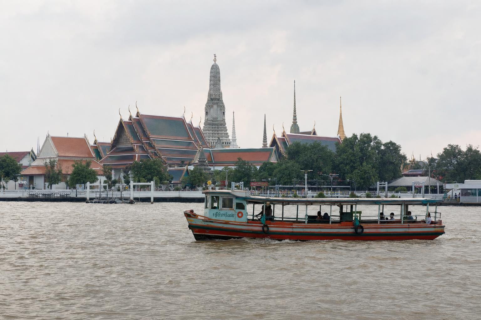
Discover Bangkok’s heart by weaving through its distinct riverside neighbourhoods—Rattanakosin’s royal temples, Kudi Chin’s multi-faith riverside community, and the dynamic bustle of Yaowarat (Chinatown). This two-day loop showcases the Chao Phraya River’s role in connecting tradition, migration, and vibrant street life, all linked by short ferry rides, metro stations, and scenic walks.
AI illustration · Wardhead AI · AI-generated illustration
Introduction
Bangkok, Thailand’s capital, is a city shaped by the sweep of the Chao Phraya River. While many travelers dash between ‘must-see’ spots, a more rewarding approach is to experience the city’s distinct riverside neighbourhoods—the Old City (Rattanakosin), the historic enclave of Kudi Chin, and Chinatown’s Yaowarat—by linking them with river crossings, riverfront walks, and local transport. Official Thai tourism sources emphasize this circuit as the ideal way to absorb Bangkok’s centuries of royal history, cultural coexistence, and lively commerce in just 48 hours.
Getting Oriented: Area and Transfers
Rattanakosin (Old City), Kudi Chin, and Yaowarat all sit beside or within easy reach of the Chao Phraya River. Thai tourism authorities recommend hopping between these clusters using Chao Phraya Express Boat or local river ferries, supported by well-marked riverside piers. The MRT Blue Line (with key stations at Wat Mangkon, Sam Yot, and Sanam Chai) creates multi-modal links between the Old City, Chinatown, and the river, simplifying journeys without needing long overland transfers.
Practical note: While many piers and services are described in official guides, there is no single published list that pairs each pier to a step-by-step two-day itinerary. Travelers should consult up-to-date maps or signage at each stop.
Day 1: Rattanakosin History to Kudi Chin’s Riverside Heritage
Morning: Rattanakosin’s Temples and Palaces
Rattanakosin, often known as Bangkok’s Old City, forms the core of the city’s heritage on the eastern Chao Phraya riverbank. Official Bangkok metropolitan sources identify this area as home to major monuments like Wat Pho (famed for its Reclining Buddha), located alongside the Grand Palace. Arrive by river—riverboats and ferries stop near this district—and take a walking tour through ornate temple grounds, museum courtyards, and heritage streets. The layout encourages moving between major sites on foot, accentuating shifts from sweeping palace roofs to local shrines and stately pavilions.
Midday: Cross to Kudi Chin — A Riverside Enclave
Board a ferry or riverboat west to the Thonburi side to enter Kudi Chin. Tourism Thailand describes this neighbourhood as a compact, walkable community with a rare blend of Portuguese, Chinese, Muslim, and Thai heritage. The district’s modest scale supports a seamless transition from river pier to its quiet lanes, where Catholic churches, mosques, and Chinese shrines nestle among historic homes and bakeries.
Afternoon: Meander Through Kudi Chin
Spend the afternoon exploring Kudi Chin’s points of cultural interest. On a self-guided walk, move from distinctive places of worship to riverside homes and artisanal bakeries. Official guides underscore Kudi Chin’s unique character as a neighbourhood where historic religious landmarks and daily life intertwine within just a few blocks. The walkable scale makes it an ideal half-day stop.
Optional: Chao Phraya Sky Park
For a panoramic view, head to the Chao Phraya Sky Park. As described on official tourism sites, this elevated park and walkway spans the river across Phra Pokklao Bridge. The Sky Park connects both riverbanks and offers three viewing points with unique perspectives on the cityscape and riverside activity—a novel vantage for photos or a restful pause before returning to the Old City.
Evening: Return or Move On to Yaowarat
As day fades, return by ferry to Rattanakosin for a riverside dinner or consider transitioning directly to Yaowarat via the MRT Blue Line or taxi if you prefer to end your evening with vibrant street food and city lights. Each cluster offers riverside or near-river accommodations, making it easy to plan an overnight based on your interests.
Day 2: Slow-Food, Markets and Streetlife in Yaowarat
Morning: Yaowarat’s Lively Streets and Temples
Begin your second day in Yaowarat, Bangkok’s Chinatown, renowned in official sources for its food streets, gold shops, herbalist stores, and market lanes. Use the MRT Wat Mangkon or Sam Yot stations for direct access. Stroll through shaded side alleys, visit multi-faith shrines, and admire the layered shophouse architecture—a living memory of successive waves of Chinese migration. Major street markets bustle from morning, making this a vivid entry point into Bangkok’s living traditions.
Afternoon: From Markets to Street Food
As the day progresses, Yaowarat transforms. Food vendors line the main avenue, with restaurants, dessert stalls, and coffee shops inviting visitors to sample Bangkok’s legendary Chinatown cuisine. Official tourism materials highlight special excitement during festivals such as Lunar New Year and the Vegetarian Festival, when the area erupts in parades, ceremonial performances, and local festivities. Whether or not your visit aligns with these events, the district’s culinary reputation makes it a rewarding lunch and afternoon stop.
Evening: Riverside Stroll or River Transfer Return
End your 48-hour loop with an evening stroll along the river, or return toward Rattanakosin by river or MRT, watching as lit-up boats glide past riverbank temples and city towers. This final river experience ties together Bangkok’s identity as a city rooted in movement—across water, through cultures, and between eras.
Planning Tips for an Efficient Loop
- Use river ferries and Chao Phraya Express Boat to make short, direct hops between the main neighbourhoods; they avoid traffic and deliver you to walking-distance sights.
- The MRT Blue Line (Wat Mangkon, Sam Yot, Sanam Chai) provides fast, straightforward access to both Old City and Chinatown. Transfer between river piers and metro stations as needed.
- Allocate roughly half a day to Rattanakosin, Kudi Chin, and Yaowarat, as all are described in official materials as walkable and compact.
- For the Sky Park, look for the Phra Pokklao Bridge crossing. This unique pedestrian park offers river views and links both banks.
- No official single-page guide matches each pier with every itinerary step. Use physical maps, signage, or ask staff at piers for the latest advice on cross-river connections.
Summary
This two-day riverside journey uncovers the contrasting personas of Bangkok: regal temples, cosmopolitan multi-religious quarters, and the everyday dynamism of Chinatown. By taking to the river and walking through these riverside enclaves, travelers can unlock a deeper sense of the city’s diversity in an accessible, source-supported way.
Key takeaways
- Bangkok’s Rattanakosin, Kudi Chin, and Yaowarat can be efficiently experienced in a connected 48-hour loop using river transport and local walks.
- Rattanakosin offers classic temples and state monuments like Wat Pho, easily accessed from the river.
- Kudi Chin is a compact riverside enclave known for its multicultural atmosphere and walkable heritage sites.
- Yaowarat (Chinatown) is Bangkok’s vibrant street food and market heart, best explored on foot from convenient MRT stations.
- Using short ferry rides and the MRT reduces dependence on Bangkok’s crowded roads.
- No official single source provides a step-by-step pier-to-pier itinerary, so check signage or ask locally for transfer advice.
Comparisons & planning
| Neighbourhood | Signature Sights | Transport Access | Official Source |
|---|---|---|---|
| Rattanakosin (Old City) | Wat Pho, Grand Palace | Chao Phraya Express Boat, MRT Sanam Chai | Bangkok Gov, Tourism Thailand |
| Kudi Chin | Santa Cruz Church, mosques, Chinese shrines | Ferry from Old City piers | Tourism Thailand |
| Yaowarat (Chinatown) | Street markets, Chinese shrines, historic shophouses | MRT Wat Mangkon/Sam Yot | Tourism Thailand, TATnews |
| Chao Phraya Sky Park | River views, three viewing points | Access from Phra Pokklao Bridge | Tourism Thailand |
Travel checklist
- Plan boat/ferry transfers between Rattanakosin and Kudi Chin using official riverside piers.
- Allocate at least half a day for each neighbourhood to appreciate their distinct atmospheres.
- Use the MRT Blue Line (Wat Mangkon, Sam Yot, or Sanam Chai) for fast connections between Old City and Chinatown.
- Walk the Chao Phraya Sky Park for panoramic views of the river and both city banks.
- Consult local maps and ask at piers for specific transfer instructions as there is no official, detailed two-day pier guide.
- Experience Yaowarat’s street food scene, especially during festival seasons if possible.
Frequently asked questions
Which transport options connect Rattanakosin, Kudi Chin, and Yaowarat?
Chao Phraya Express Boat and local ferries serve the riverfront for short hops between neighbourhoods. The MRT Blue Line (stations: Wat Mangkon, Sam Yot, Sanam Chai) provides rapid connections between the Old City and Chinatown, as promoted by Tourism Thailand and TATnews.
How long should I allocate to each neighbourhood?
Official materials describe Rattanakosin, Kudi Chin, and Yaowarat as compact and walkable, making each suited to half-day exploration. A full 48-hour itinerary generally allocates one half-day per neighbourhood, plus extra time for evening riverside or festival experiences.
Are there official guides for which piers to use for each transfer?
There is no single, authoritative official guide that matches every transfer step-by-step with named piers for a two-day loop. Official sources describe generic river services and pier clusters. Travelers should consult up-to-date maps or ask for assistance at the piers.
What makes Kudi Chin distinct from other riverside areas?
Kudi Chin is notable for its historic mix of Portuguese, Chinese, Muslim, and Thai influences, reflected in its religious sites and architecture. Official sources highlight the neighbourhood’s walkable scale and layered heritage as a highlight for cultural travelers.
Sources and research notes 4 sources
Based on official source material. Check provider websites for changing visitor details.
Conversation
Sign in or create an account to join the conversation.